-40%
The Western Pilot for 1829, Cumings. Ohio & Mississippi Rivers Navigation MAPS
$ 396
- Description
- Size Guide
Description
The Western Pilot for 1829, Cumings. Ohio & Mississippi Rivers Navigation MAPSThe Western Pilot for 1829, Cumings. Ohio & Mississippi Rivers Navigation MAPS
THE
WESTERN PILOT
CONTAINING CHARTS OF THE OHIO RIVER, AND OF THE MISSISSIPPI FROM THE MOUTH OF THE MISSOURI TO THE GULF OF MEXICO,
ACCOMPANIED WITH DIRECTIONS FOR NAVIGATING THE SAME,
AND A GAZETTEER, OR DESCRIPTION OF THE TOWN ON THEIR BANKS,
TRIBUTARY STREAMS, &C.
ALSO, A VARIETY OF MATTER INTERESTING TO TRAVELLERS AND ALL CONCERNED IN THE NAVIGATION OF THOSE RIVERS
by
Samuel Cumings
Cincinnati, N. & G. Guilford, 1829.
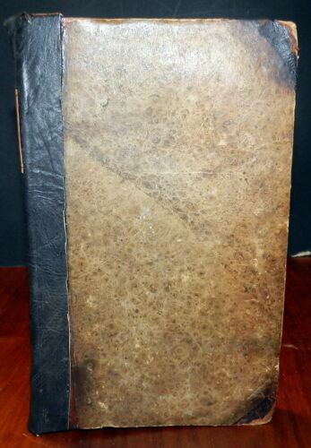
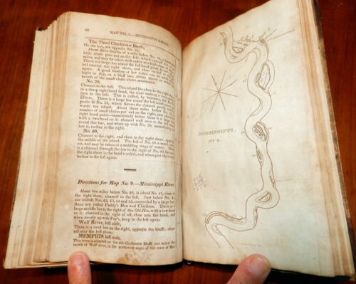
Hardcover. Original paper-covered boards, later leather spine and spine title label. Octavo. Engraved half-title, title page, [4] preliminary pages, pages [5]-104, 4 engraved plates, and 43 full-page wood-engraved maps of the Ohio (20) and Mississippi Rivers (23). The plates include views of Pittsburgh and Cincinnati, a scene on the Mississippi and a portrait of Gabrielle Menou, a French belle from the banks of the Mississipp (engraved by Charles Toppan)i.
The appendix contains descriptions taken from Flint's "Geography and History of the Western States" and
The French Village
from Hall‘s "Western Souvenir".
A revised and altered edition of the author's "Western navigator". 1822. Another edition was also published in 1825.
"Cumings's editions of the 'Navigator' and 'Pilot' ... were amplifications of [The navigator] of [Zadoc] Cramer, without acknowledgment of the main source of their material."--Sabin, Bibl. Amer., v. 5, p. 126. t Cuming’s guides were the most important aids of river pilots during the pre Civil War period. The charts, including twenty of the Ohio River and twenty-three of the Mississippi River, illustrate all the bars and currents, necessarily revised frequently due to the ever-shifting Mississippi.
Subjects:
Ohio River -- Description and travel. Navigation
Mississippi River -- Description and travel. Navigation
CONDITION:
The boards have edge and corner wear, dented edges and are bowed.
The preliminary pages including the half-title and title pages have dampstains. The text pages are complete and intact with light stains, spots and darkening. Some of the page margins have annotations and calculations presumably made by a pilot. The maps and engraved plates are complete and intact with soil and light stains and all are very readable. The binding is tight.)
Check our other auctions and store listings for additional unusual items
Check our other auctions and store listings for additional unusual items
Listing and template services provided by inkFrog


